
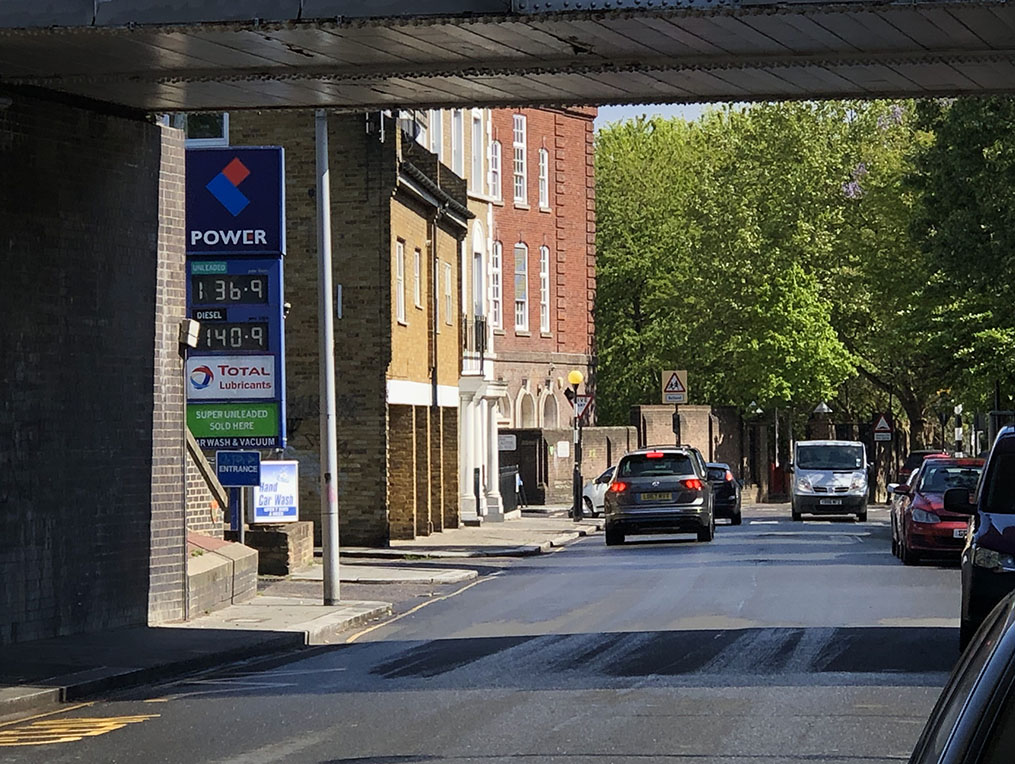
A blustery and somewhat wet (in fact, chucking down hailstones) afternoon in amongst bright patches on a Bank Holiday Saturday gave me my overdue next opportunity for some Sweenealogical wandering. After a bit of deliberation the previous evening, I’d chosen to begin in the shadow of the Westway, and the even darker one of Grenfell Tower, for some Season 2 action.

Thus after arriving at Waterloo, I took the Jubilee Line to Baker St followed by the Circle to Latimer Road. I chose to ‘come in from the top’ of the location set to the west of the station and work downwards, so walked North up Bramley Road and then turned into Darfield Way, weaving between the tower blocks and the Westway overpass to arrive at the end of a slight cul–de–sac and the first spot on the itinerary.
Episode Context – S2E04, “Big Brother”
A gang of armed robbers has beaten and kidnapped a security guard during a raid; they haul him into the back of their van and tear away from the scene, whilst using bolt cutters to separate him from his briefcase. We see the getaway van in a medium shot coming round a corner in front of some low–level flats, with a tower block in the distance (1).

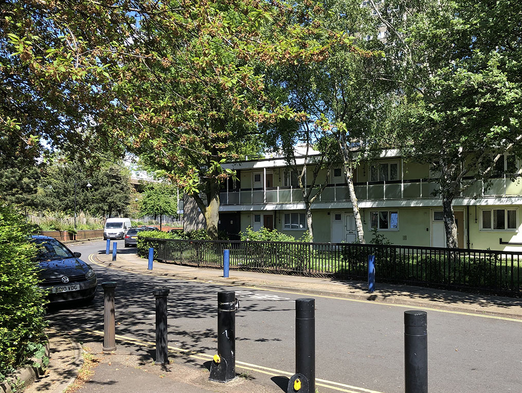
As you can clearly see, during the 70s this was filmed from an area of muddy, derelict waste ground that sits in and around where the A3220 ‘W Cross Route’ joins the Westway, and there was little to no foliage around at the time. If you look closely at the 2nd picture (taken during one of the sunnier intervals), you can see the tower block sitting behind the lower–level flats (there’s a few blocks of these, which seem to have been modelled on American motels). The buildings themselves have changed very little, compared to the surrounding area.
Turning around slightly and heading underneath the A3220 ramps (2), is where the robbers’ van did some archetypal ‘doughnutting around in the mud on waste ground’, so beloved of Sweeney car chases, before dumping the security guard out of the back. First we see a shot looking into the waste ground as the van enters:


The area between the ramps is now a given over to a mixture of leisure (football pitches and tennis courts) and various light industrial and mechanical businesses, as well – as you can see – one of the plethora of Grenfell memorials that proliferate in this area.
Flipping the POV, we then look outward from between the ramps as the van comes towards us:

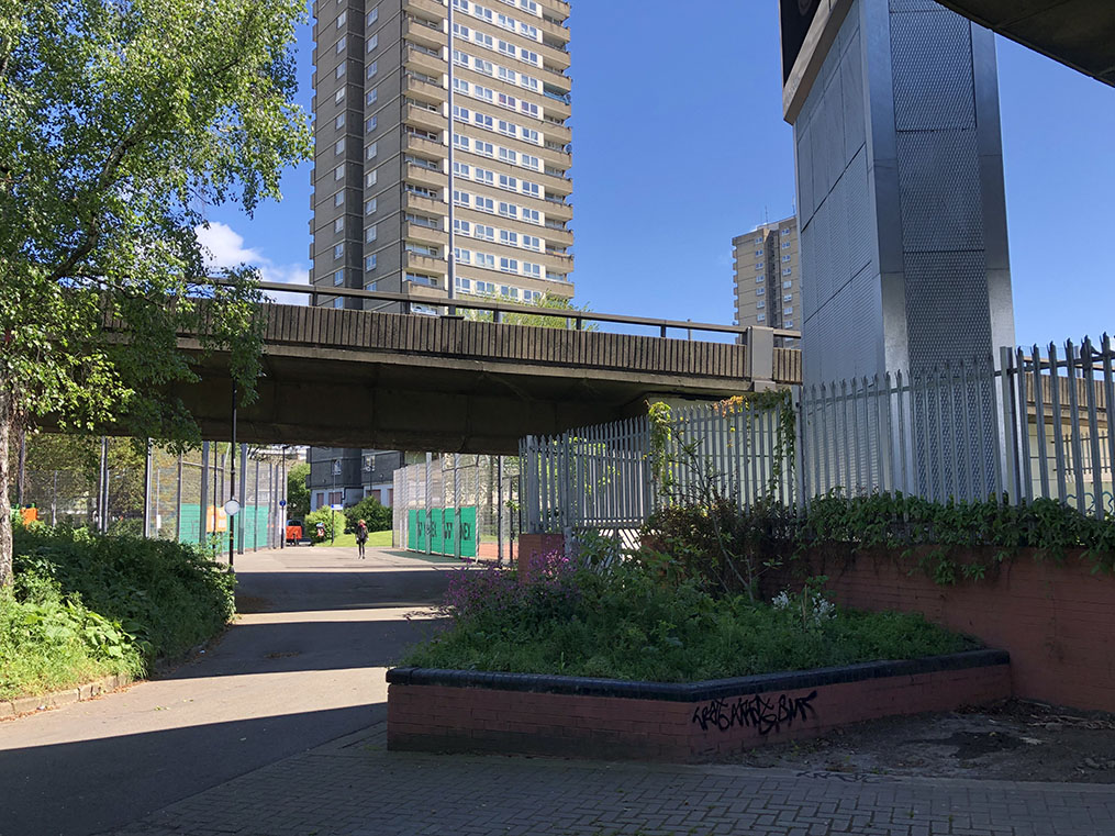
Due to the pitches, businesses etc. (and the wall hosting the previously seen Grenfell memorial), I couldn’t get quite far enough in underneath the ramps to recreate the shot accurately; but the gist is fairly apparent. The roadways and tower blocks are the dominant features that still remain, whilst the area itself looks at least a little tidier.
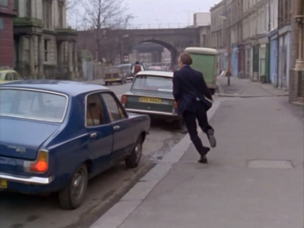
Nipping back out towards Freston Road, the next spot (3) is where, later in the episode, Regan and Carter pick up Angela, an ‘associate’ of one of the episode’s suspects (though not actually a suspect of the robbery) and bring her in for questioning. We first see them walking towards the top of Freston Road, only a short distance from where we saw the robbers’ van heading for the waste ground. (This turns out to be quite common, where several shots from an episode will all be filmed in a small area but from different directions, angles, “just round the corner” etc. to make them look like different places. A natural economy of filming, as it means you don’t have to up the entire cast and crew and relocate them quite so often and thus cost your production more time and money.)


Again, I couldn’t get quite far back enough to frame the shot more as in the original (tennis court in the way) but the general view is the same. The tower hasn’t changed, though I believe the wall in front has been rebuilt. There’s a new garage block or something at the left of the wall nowadays, and the general impression as with most areas of London is that there is ‘more stuff’ around, even where the older elements still persist.
We track Jack, George and Angela along the wall, past a school on their left (on the right of these pictures):

Clearly the school building is little changed, just perhaps ‘cleaned up’ a bit. Finally, they get into the trusty Ford Consul that is parked at the end of Freston Road:
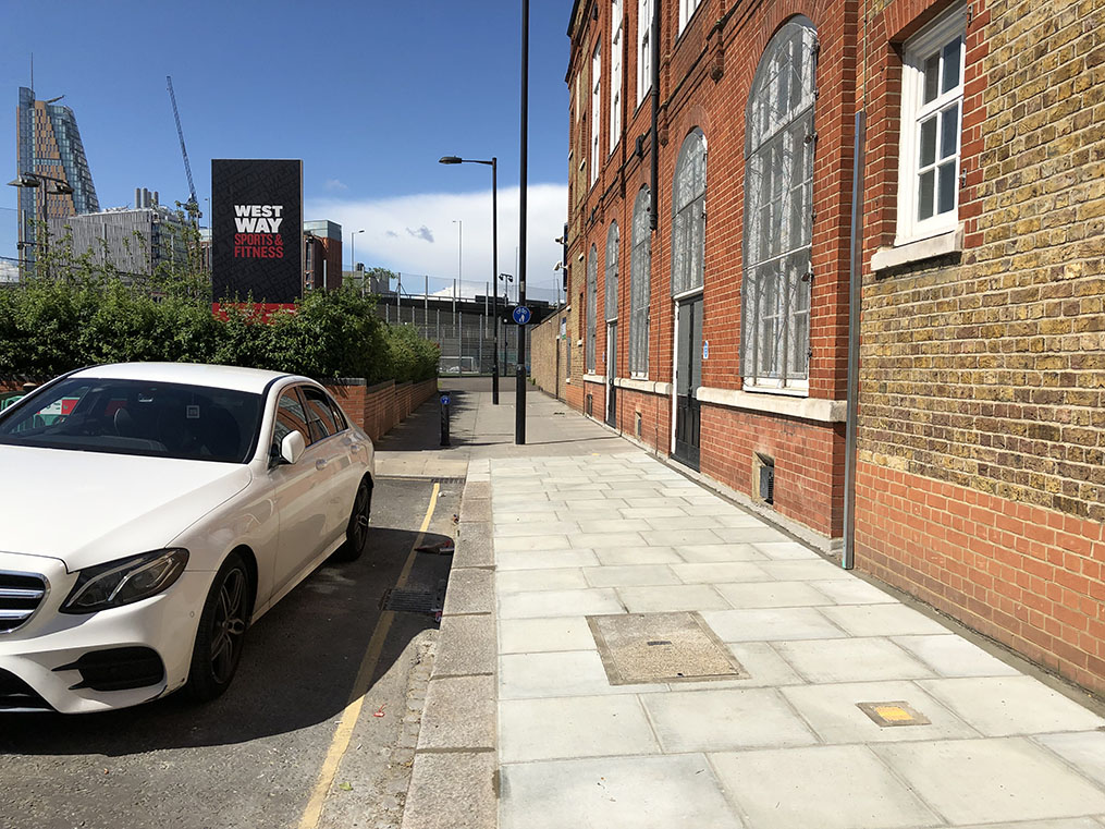
(Alas I only got a boring Merc.) It looks as if nowadays the road ends slightly sooner, with the raised planter type affair blocking the way; in the 70s shot, the car is parked further ‘into’ the 2nd picture, near the lower wall you can see in the middle distance that provides access to the school grounds.
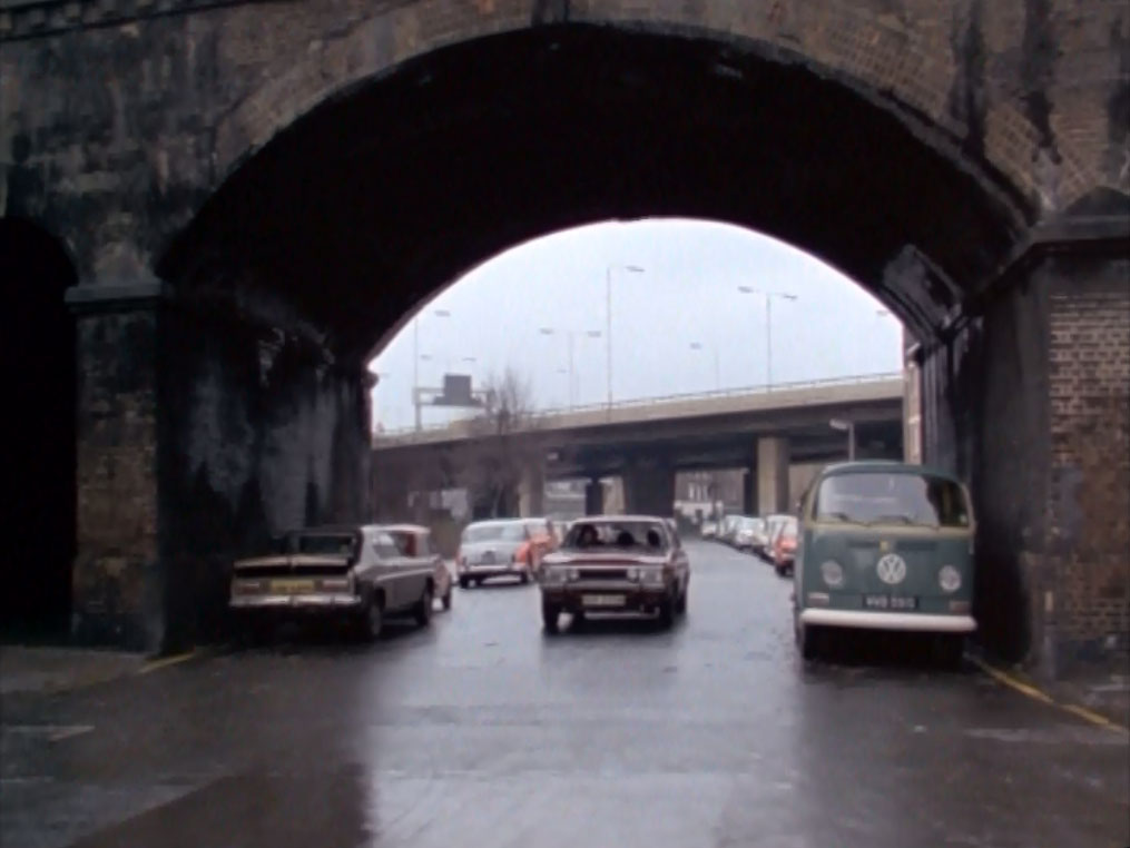
After this, they drive away down Freston Road:


Two obvious features still exist today, namely the railway bridge and the building behind it. You can see though how much new building has taken place along the road in the intervening years, and it all now feels a lot more ‘closed in’.
Walking SE (in the direction of Consul travel) back down Freston Road, we can pick up another shot from earlier in the episode (4), this time looking NW back up the road from the other side of the bridge. This was used for a medium to long range view of the armed gang (the two principals of which were named Lee and Deacon) escaping the scene in their blue van:


The episode shot was obviously taken from a slightly higher vantage point than “person on foot with phone”, and so affords a greater view of some of the buildings that were the other side of the bridge at the time. One or two of them are still just recognisable from their features in the right-hand shot; as with much of the area though, you can see that the majority of the buildings along the road are either new or have been rebuilt.
Working backwards in the episode’s timeline, we can wander round the corner from here into Bard Road (5) where the ambush on the security guards took place. On the left here, the van is approaching the ambush site:

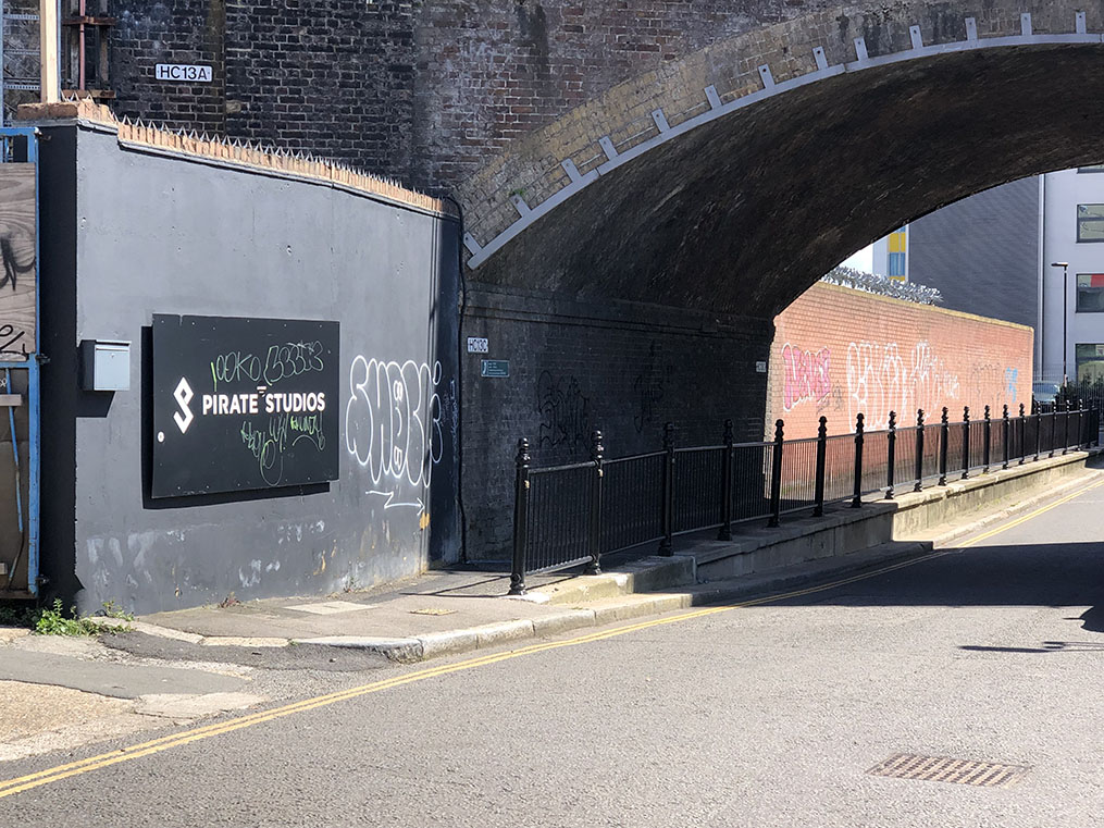
The railings have obviously been replaced, and there are now new buildings in the background. Along the side of the road there are now a lot more industrial units, studios etc. where previously there were either empty lots or different buildings. Walking back under the railway to the corner of Bard Road, towards where it turns into Freston Road, we see a POV shot as the gang is escaping:


This gives a clearer view of how many new buildings are now in the area; the higher wall has been built on the left, and you can no longer see the tower block in the middle distance.
From here, it was a little walk back up past Latimer Road station, and slightly to the North East (even closer to the looming reminder of Grenfell Tower) where, in amidst trying to shelter as best I could from a hailstorm, I collected two shots the location for which were pinned down via some painstaking Google Map pondering. As with several we’ve encountered already, this is a case of two scenes from separate parts of the episode being filmed in the same location. They’re on Kingsdown Close at yet another railway bridge, with the Westway lurking in the background. Firstly we see Regan and Carter in the Ford, as they are bringing Angela back to the factory for questioning; later on, we see them chasing Linbert Rea, the previously mentioned ‘associate’ of Angela’s, and whom it turns out was actually responsible for the beating imparted on Andy Deacon that initially, Deacon’s older brother suspects Regan of having dished out whilst Andy was in custody.

The railway bridge is obviously unchanged; and in the top-left shot of the episode with the Consul headed towards us, you can clearly see the Westway behind the bridge. (To find the location I shifted the Google Map around till I could find somewhere with a bridge through which you ought to be able to see the Westway close behind, and then went into Streetview to confirm.) The bottom-left picture had me confused for a while; there’s an almost identical bridge on Silchester Road, a longer residential street, and I thought it might have been taken there. However, if you zoom the shot in a bit, you can actually see the Westway through the bridge as in the other two; this is more or less the only railway bridge in the area where that would be the case, hence I’m fairly certain the two shots were just taken at two points on the same road. Here again, the road and rail architecture is more or less unchanged, whilst the majority of the residential buildings have long since been demolished and new ones built in their place.
With that, I was done with ‘Big Brother’ for the time being; heading up under the Westway and a short distance East, we come across a location from the previous episode in Season 2.
Episode Context – S2E03, “Supersnout”
With DCI Haskins away at a conference in Toronto, The Squad is temporarily under the command of Quirk, a blustering ex-military type who seems obsessed with capturing a mythical “Post Office Gang”. The episode contains many references to ‘Moby Dick’, and it is Quirk’s “Great White Whale”, Yanos, for whom Regan and his team are instructed to go full-steam-ahead. We see them set off on this pursuit from Malton Road (1), right under the Northern edge of the Westway:
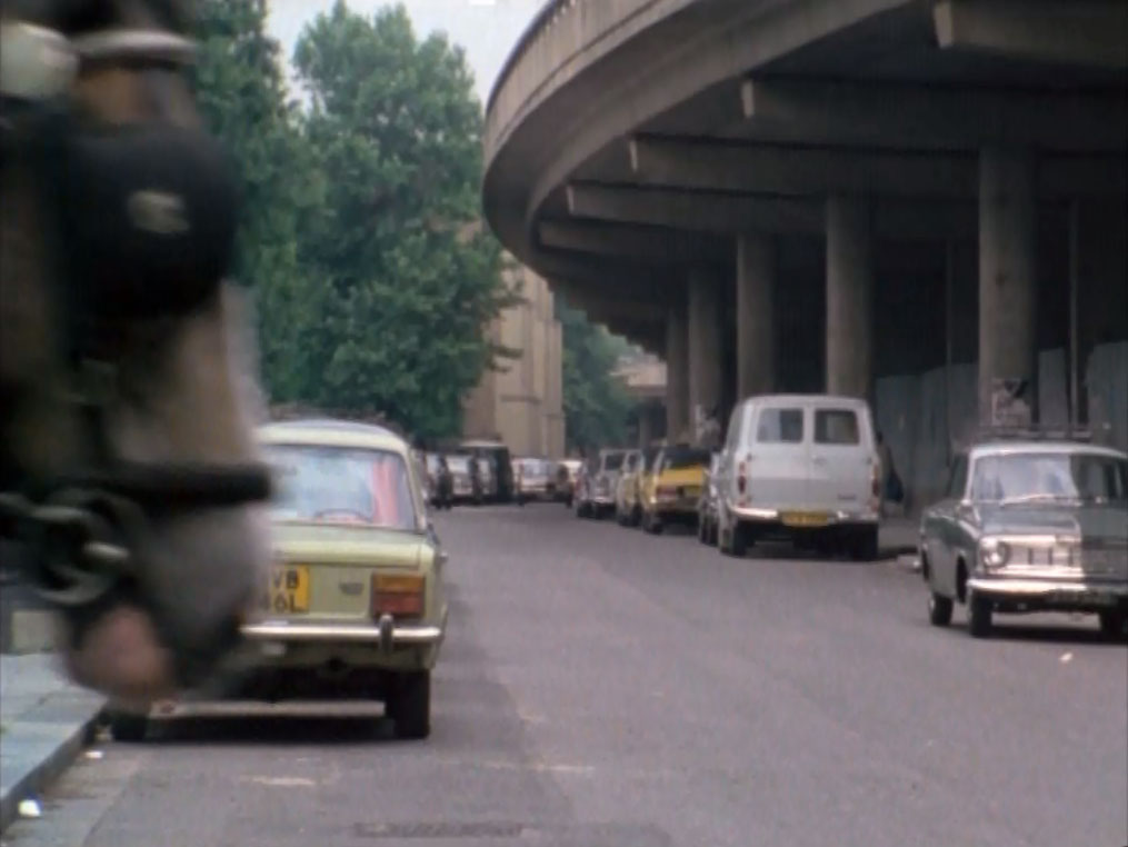

Not much has changed here, obviously, besides the style of the cars and a little growth in foliage. (Oh, and the fact that I was unable to get a rag n bone horse to wander into my shot for me on this particular Saturday afternoon.)
As we look ‘into’ the shot above, the squad car comes towards us and turns left (our right) down St. Marks Road, under the Westway and the railway (2):
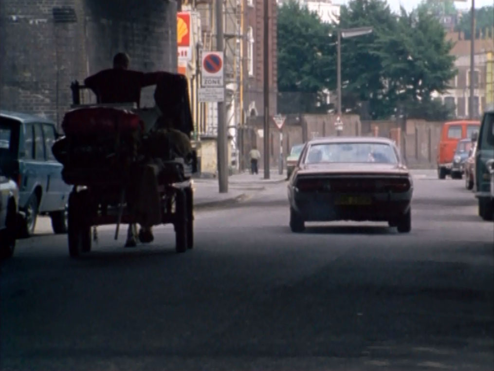
Quite unexpectedly, for current times, the petrol station is still there on the left – though no longer a Shell; the buildings beyond on the left, and then the low brick wall are still there also and unchanged (though, in a far less unexpected turn of events, have been cleansed of the ubiquitous 70s grime present on the episode shot). The increase in tree cover prevents us seeing much beyond this now, although the buildings further down the road are also mostly still there.
From these two shots – both of which were also ‘Google scouted’ by looking on the map for anywhere that could match up to what I’d seen on screen – we about-turn and head up along Portabello Road, through the bustling market and street food stalls – and back one more episode – for the last few locations of the day.
Episode Context – S2E02, “Faces”

Tober and ‘Evil Wille’, two members of a gang with… ‘questionable’ political views, run their operation from out of Tober’s junk shop on Goldborne Road. Carter breaks in to try and scope them out, but is nearly caught in the act and has to scarper out the back extremely quickly. (Tober’s gang have enough at stake that they wouldn’t think twice about eliminating anyone who was a threat, police or otherwise). Having walked East from Portobello Market along Raddington Road, turning left into Blagrove Road we shortly come across the first of this excursion’s locations from this episode, the former ‘Bevington Arms’ pub from which we see Tober and Willie returning one evening (1):

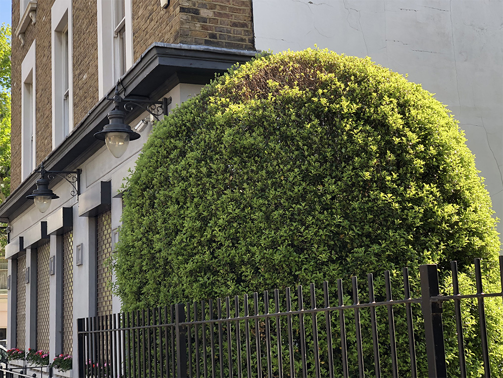
Predictably, it’s no longer a pub and instead is a private dwelling; the architecture however, apart from the expected spit-shine, is as can be seen more or less unchanged. The narrow strip of open land between the pub and the next row of houses is still there, now sporting a lump of topiary; almost a surprise these days to see a postage stamp of London earth that hasn’t been sold off and built on.
Further up the same road – though it now becomes Bevington Road – we come across another surviving anachronism of old London, an underground public lavatory (2). This is where Carter dashes into to hide, having been rousted from the junk shop by Tober. We see George running up Bevington Road towards us, having come out the back of the shop:
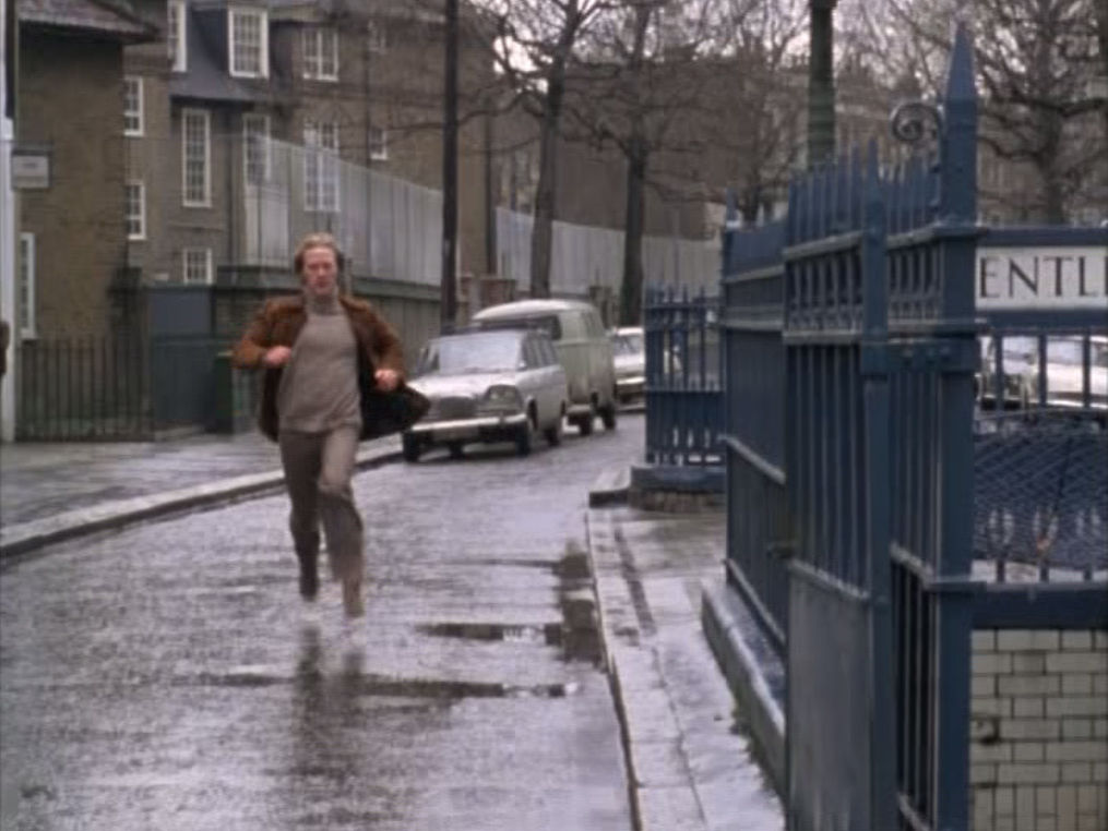
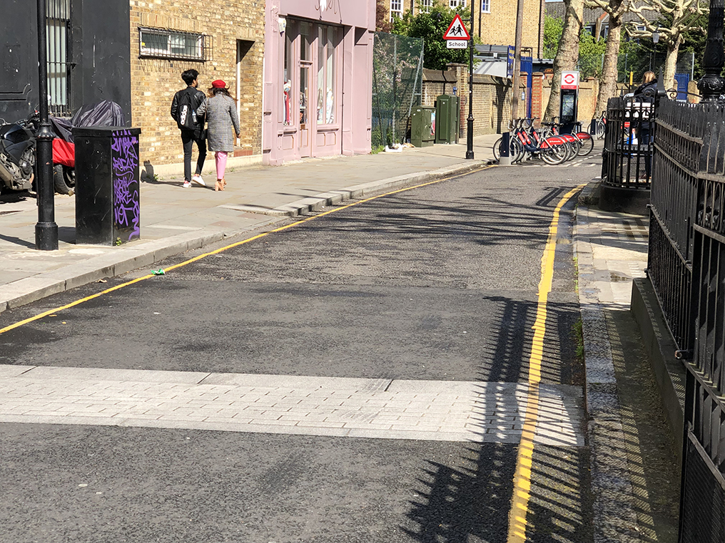
The railings have been given a new coat of paint or two in the intervening years, but besides that I doubt if it has changed much. You don’t see inside the toilets during the episode; having availed myself of the facilities, I doubt you’d get much more than a person with a small handheld camera in there anyway, and would certainly struggle with any lighting or sound gear. (Nice to see a public loo that’s free, though.) Behind George’s head, you can see Bevington Primary School – which, per usual ‘brickwork cleaned up’ – you can see in the modern-day shot looking otherwise much the same. Most of the other buildings are still the same as well, with just cosmetic face lifts.
Finally for this visit, just around the corner in Goldborne Road (3) we come to the location of the junk shop. We see both sides of the street, as Tober pauses across from the shop (on the North side of the road) to make sure the coast is clear before entering:

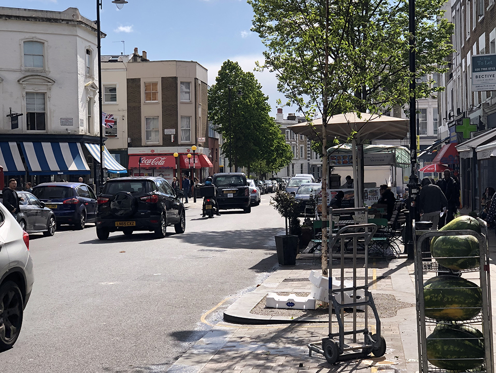
Whilst the markets and shops along here are clearly a bit more up-market these days, the buildings themselves are no different, as you can see when matching them up; for example the building ‘on’ Tober’s left shoulder is the one now sporting a Coca Cola awning.
Once Tober has satisfied himself that nobody is following, he turns and crosses the road into the shop:
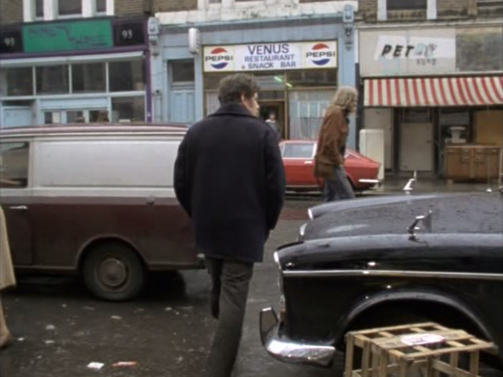
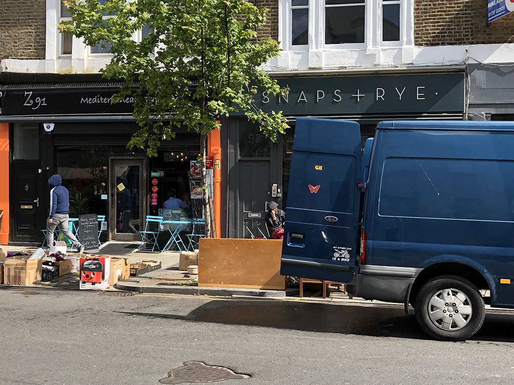
On the 70s picture, the shop is the one to the far right (‘Pet’); unfortunately it was too hidden by a parked van for me to want to include in the frame. The left-hand shop (’91’ – you can’t really make out what it is in the episode shot) is now ‘Zayane’, a mediterranean’ restaurant, whilst the rather excellent looking ‘Venus Restaurant Snack Bar’ is now the far less appealing ‘Snaps + Rye’, a ‘modern Nordic restaurant’. (Yeah, I’m sure it’s lovely; but it’s just so… very. I’d be far more excited to find a proper old greasy spoon these days.)
And with that, it was time to head back to Waterloo and rejoin the family!
